|
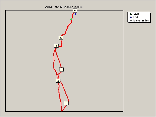
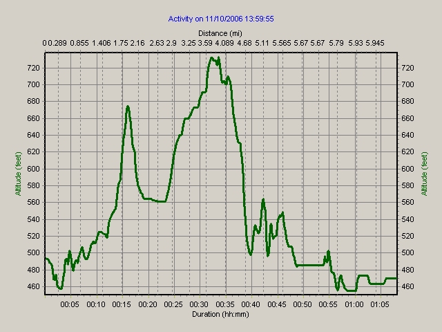
Course Profiles
2006/2007 Season
For
some added interest to the league activities here are the course profiles of
some of the more recent fixtures held. The data was recorded via a Timex
Trailrunner GPS device.
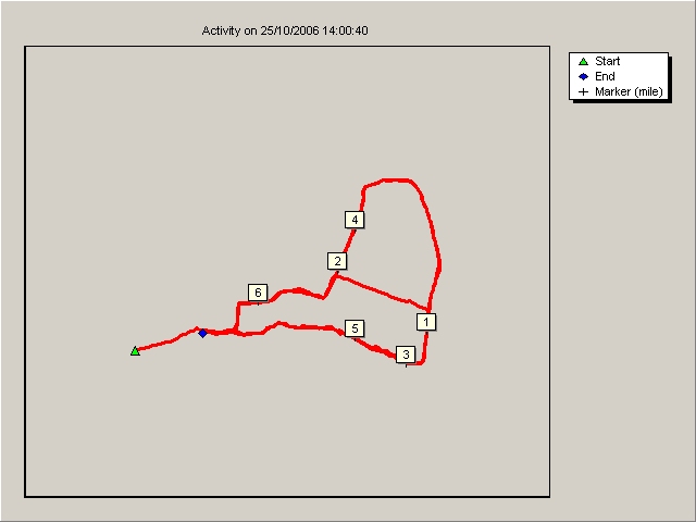
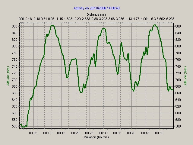
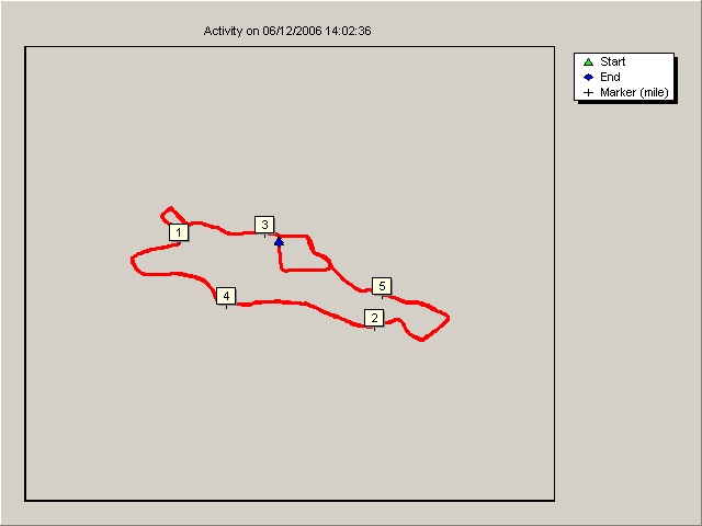
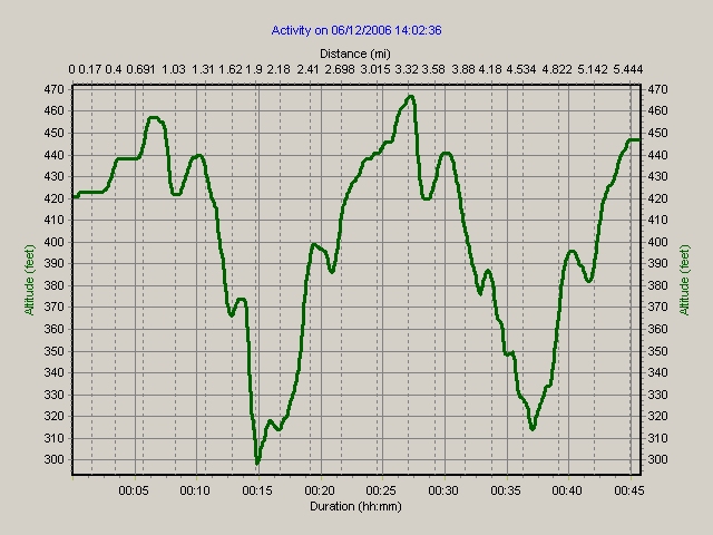
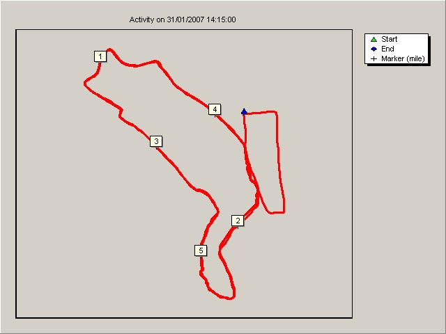
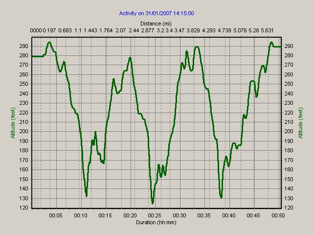
 Cumbria - Lowther Park
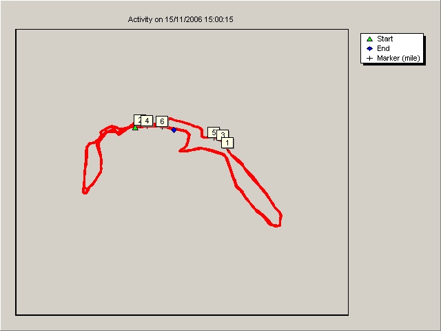
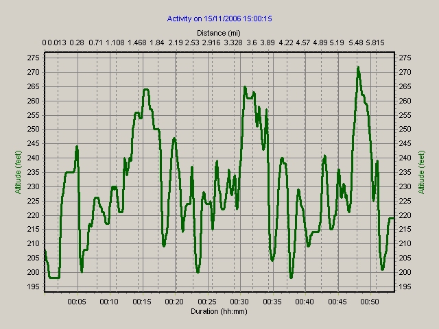
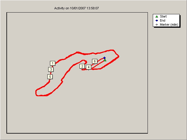
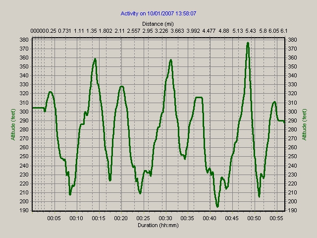
Cleveland - Osmotherley
Cheshire - Wilmslow Rugby Club
Derbyshire - Chesterfield
West Yorkshire - Leeds Stadium
South Yorkshire
- Mexborough
Lancashire -
Clayton
GMP - Hough End
All
profiles are based on the men's courses. The ladies courses are usually 2/3 the
distance.
Cumbria - Lowther Park
Cleveland - Osmotherley
Cheshire - Wilmslow Rugby Club
Derbyshire - Chesterfield
West Yorkshire - Leeds Stadium
South Yorkshire - Mexborough
|
Mile Marker |
Split
(hh:mm:ss) |
Lap
(hh:mm:ss) |
Distance
(mi) |
Avg Speed
(mph) |
Avg Pace
(min/mi) |
Elev. Change
(feet) |
Ascent
(feet) |
Descent
(feet) |
Altitude
(feet) |
Latitude |
Longitude |
|
Start |
00:00:00 |
00:00:00 |
0 |
0 |
99:59:00 |
0 |
0 |
0 |
279 |
N 53° 30' 29" |
W 1° 13' 54.1" |
|
1 |
00:08:56 |
00:08:56 |
1.002 |
6.7 |
08:55 |
-60 |
15 |
63 |
219 |
N 53° 30' 35.6" |
W 1° 14' 21.4" |
|
2 |
00:17:40 |
00:08:45 |
2.001 |
6.9 |
08:46 |
23 |
142 |
127 |
242 |
N 53° 30' 13.6" |
W 1° 13' 55.3" |
|
3 |
00:24:27 |
00:06:47 |
3.002 |
8.9 |
06:47 |
-117 |
30 |
150 |
125 |
N 53° 30' 24.2" |
W 1° 14' 10.8" |
|
4 |
00:33:58 |
00:09:31 |
4.002 |
6.3 |
09:31 |
157 |
172 |
15 |
282 |
N 53° 30' 28.5" |
W 1° 13' 59.7" |
|
5 |
00:41:28 |
00:07:30 |
5.003 |
8 |
07:29 |
-100 |
49 |
145 |
182 |
N 53° 30' 9.6" |
W 1° 14' 2.4" |
|
End |
00:45:31 |
00:06:03 |
5.667 |
4.4 |
06:37 |
107 |
117 |
15 |
289 |
N 53° 30' 28.8" |
W 1° 13' 54.2" |
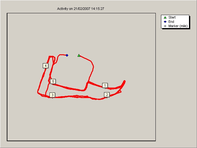
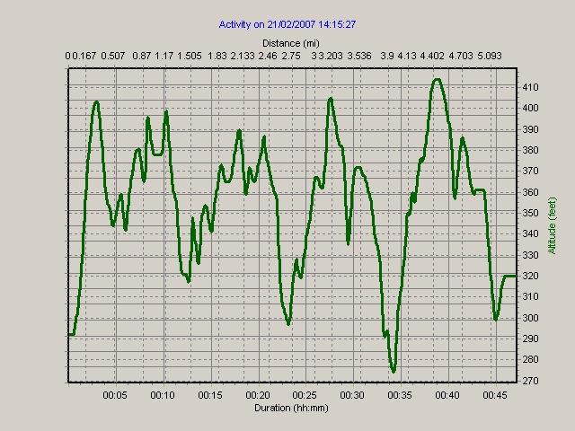
Lancashire - Clayton
|
Mile Marker |
Split
(hh:mm:ss) |
Lap
(hh:mm:ss) |
Distance
(mi) |
Avg Speed
(mph) |
Avg Pace
(min/mi) |
Elev. Change
(feet) |
Ascent
(feet) |
Descent
(feet) |
Altitude
(feet) |
Latitude |
Longitude |
|
Start |
00:00:00 |
00:00:00 |
0 |
0 |
99:59:00 |
0 |
0 |
0 |
292 |
N 53° 46' 57.5" |
W 2° 22' 45" |
|
1 |
00:08:59 |
00:08:59 |
1 |
6.7 |
08:59 |
86 |
146 |
60 |
378 |
N 53° 46' 47.9" |
W 2° 22' 34.9" |
|
2 |
00:17:22 |
00:08:23 |
2.005 |
7.2 |
08:21 |
-3 |
62 |
69 |
375 |
N 53° 46' 45.1" |
W 2° 22' 34.2" |
|
3 |
00:25:53 |
00:08:31 |
3 |
7 |
08:33 |
-9 |
82 |
98 |
366 |
N 53° 46' 45" |
W 2° 22' 55.2" |
|
4 |
00:34:38 |
00:08:45 |
4.007 |
6.9 |
08:41 |
-64 |
92 |
145 |
302 |
N 53° 46' 53.7" |
W 2° 22' 57.9" |
|
5 |
00:43:44 |
00:09:06 |
5.002 |
6.6 |
09:09 |
58 |
113 |
48 |
360 |
N 53° 46' 49" |
W 2° 22' 54.9" |
|
End |
00:47:11 |
00:03:27 |
5.218 |
3.8 |
15:59 |
-40 |
16 |
63 |
320 |
N 53° 46' 57.5" |
W 2° 22' 49.7" |
GMP - Hough End
 More information:
Feature on Timex
Trailrunner GPS device
More information:
Feature on Timex
Trailrunner GPS device

|